Thessaloniki gets ready for its metro launch in November
The underground rapid transit lines have been under construction for almost two decades due to various project delays
The underground rapid transit lines have been under construction for almost two decades due to various project delays

The cross pinnacle on the Tower of Jesus Christ will be ready to receive visitors in 2026 on the centennial of Gaudi’s death

Now you can get your wine in Talence by paying directly in Bitcoin

That’s because the state has to spend money on updating the railway infrastructure rather than subsidizing the cost of the popular pass

Steffen Romstöck said that he would respect the residents’ choice and would take over the helm of the municipality, even if he didn’t run

The measure, which will come into force from 1 January 2025, will be partial and temporary…for now

Rethinking renewable energy sources for the urban landscape

But operating them is still illegal under the country’s legislation

The examples, compiled by Beyond Fossil Fuels, can inform and inspire communities and entrepreneurs that still feel trepidation at the prospect of energy transition
Now you can get your wine in Talence by paying directly in Bitcoin
Rethinking renewable energy sources for the urban landscape
The examples, compiled by Beyond Fossil Fuels, can inform and inspire communities and entrepreneurs that still feel trepidation at the prospect of energy transition
The underground rapid transit lines have been under construction for almost two decades due to various project delays

Plus, it has a unique modular design that allows it to be shortened and lengthened like a train

At least, that’s the promise made by the mayor of Paris, Anne Hidalgo

Despite its church-y name, the district has long been known as the hangout spot for the artsy crowds
At least, that’s the promise made by the mayor of Paris, Anne Hidalgo

Hostal de Pinós is located in the geographical centre of the autonomous region

On the eve of the new academic year, the ranking considers several distinct but essential factors


Following a successful trial phase, these quiet areas will now be available on all main routes in the country

The academic institution shows a deeper understanding of the well-being of its students


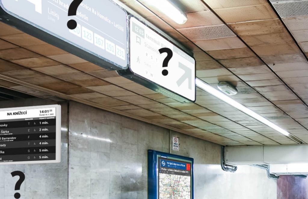
The city is working on a new unified signage navigation system, set to replace the current one which dates back to the 1980s
Without any doubt, Prague is amongst the most beautiful EU cities. However, it might often be difficult for tourists and even locals to find their way around the Czech capital, due to the outdated, hard to understand labelling, information panels and signs.
Luckily, this is about to change, as Prague city councillors are preparing the modernisation of the navigation system, which encompasses streets and public transport (see the gallery above).
On Monday, the city website of Prague announced the preparation of a project aimed to modernize the orientation system in the city. As a result, the appearance of the individual navigation elements will change towards a unified design, but also towards a larger quantity and scope of information provided.
The change comes after the City Council approved this week the implementation study of the Unified Information System of the Capital City of Prague. Said study, launched in 2017 by the former city government, presents a vision of the transformation of all important navigation elements in Prague, with the goal of their unification, better comprehensibility and maximum use of online information.
The next stage is to launch a design competition, expected this spring. It will be open to national and international designers with different portfolios, with costs reaching up to CZK 5.4 million (208 500 euros).
“The current form of the navigation system has its roots in the 1970s and 1980s. For decades, no one has systematically developed an orientation system and applied the latest findings. Prague is preparing large and also beautiful public buildings from metro D, through new tram lines to the railway to the airport.
I can't imagine that there would be an information system of the last century that would not work with what top designers can do today and with the amount of online information we have available. It's like putting a compass in a new car instead of satellite navigation," Adam Scheinherr, Deputy Mayor for Transport, was quoted saying on praha.eu.
The Mayor of Prague Zdeněk Hřib also explained that not all signs will be replaced immediately. To save money, this will happen gradually, as part of reconstructions planned for other reasons.
While the city is preparing the design competition, the newly proposed elements within the pilot will also take place at 5 transfer nodes: Florenc, Palmovka, Budějovická, Háje and Nádraží Holešovice. Here, passengers will find digital panels with online traffic information, new maps of the surroundings, comprehensive navigation within the interchange or signposts to nearby destinations.
Once pilot projects have been evaluated, this will serve as a basis to decide on the implementation of 53 proposed measures for the study or on the total costs that the new system will incur.
TheMayor.EU stands against fake news and disinformation. If you encounter such texts and materials online, contact us at info@themayor.eu
The underground rapid transit lines have been under construction for almost two decades due to various project delays

Now you can get your wine in Talence by paying directly in Bitcoin

That’s because the state has to spend money on updating the railway infrastructure rather than subsidizing the cost of the popular pass

Rethinking renewable energy sources for the urban landscape

The examples, compiled by Beyond Fossil Fuels, can inform and inspire communities and entrepreneurs that still feel trepidation at the prospect of energy transition
Now you can get your wine in Talence by paying directly in Bitcoin

The 10th European Conference on Sustainable Cities and Towns (ESCT) sets the stage for stronger cooperation between the EU, national and local level to fast track Europe's transition to climate neutrality.

At least, that’s the promise made by the mayor of Paris, Anne Hidalgo
The underground rapid transit lines have been under construction for almost two decades due to various project delays
At least, that’s the promise made by the mayor of Paris, Anne Hidalgo
Hostal de Pinós is located in the geographical centre of the autonomous region

Despite its church-y name, the district has long been known as the hangout spot for the artsy crowds
Urban dwellers across the EU are having a say in making their surroundings friendlier to people and the environment.
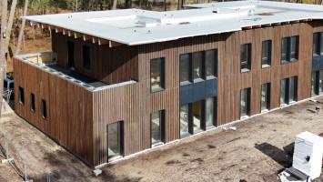
Forests in the EU can help green the European construction industry and bolster a continent-wide push for architectural improvements.

Apply by 10 November and do your part for the transformation of European public spaces
An interview with the Mayor of a Polish city that seeks to reinvent itself
An interview with the newly elected ICLEI President and Mayor of Malmö
A conversation with the Mayor of Lisbon about the spirit and dimensions of innovation present in the Portuguese capital