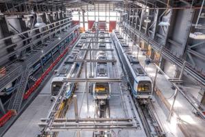
Thessaloniki gets ready for its metro launch in November
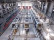
The underground rapid transit lines have been under construction for almost two decades due to various project delays
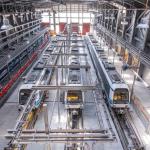
The underground rapid transit lines have been under construction for almost two decades due to various project delays
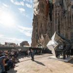
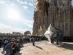
The cross pinnacle on the Tower of Jesus Christ will be ready to receive visitors in 2026 on the centennial of Gaudi’s death

Now you can get your wine in Talence by paying directly in Bitcoin

That’s because the state has to spend money on updating the railway infrastructure rather than subsidizing the cost of the popular pass

Steffen Romstöck said that he would respect the residents’ choice and would take over the helm of the municipality, even if he didn’t run
The measure, which will come into force from 1 January 2025, will be partial and temporary…for now
Rethinking renewable energy sources for the urban landscape

But operating them is still illegal under the country’s legislation
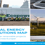
The examples, compiled by Beyond Fossil Fuels, can inform and inspire communities and entrepreneurs that still feel trepidation at the prospect of energy transition
Now you can get your wine in Talence by paying directly in Bitcoin
Rethinking renewable energy sources for the urban landscape
The examples, compiled by Beyond Fossil Fuels, can inform and inspire communities and entrepreneurs that still feel trepidation at the prospect of energy transition
The underground rapid transit lines have been under construction for almost two decades due to various project delays

Plus, it has a unique modular design that allows it to be shortened and lengthened like a train

At least, that’s the promise made by the mayor of Paris, Anne Hidalgo
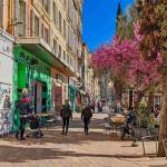
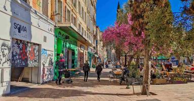
Despite its church-y name, the district has long been known as the hangout spot for the artsy crowds
At least, that’s the promise made by the mayor of Paris, Anne Hidalgo
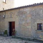
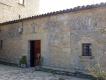
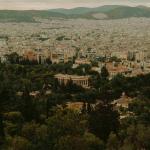
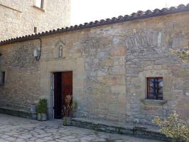
Hostal de Pinós is located in the geographical centre of the autonomous region

On the eve of the new academic year, the ranking considers several distinct but essential factors

Following a successful trial phase, these quiet areas will now be available on all main routes in the country

The academic institution shows a deeper understanding of the well-being of its students


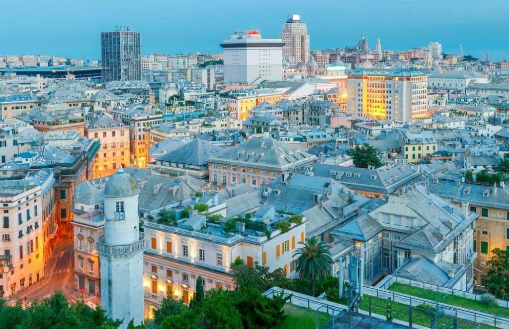
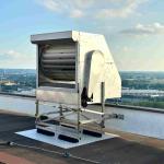
The roofs of Genoa, or any city for that matter, are under-utilized urban spaces with great potential, Source: Depositphotos
This method provides a closer and more intimate look than satellite imaging, thus creating a map that can aid optimal urban planning
The City of Genoa announced at the end of last week that it would be the first in Italy to apply multispectral aerial remote sensing to create a detailed map of its urban assets, such as roofs. This will be done with a view to optimising energy development in the Ligurian capital as the technique can aid to see how well energy is produced or wasted in specific areas or buildings.
The multi-partner project is a collaboration between the municipal authorities, City Green Light (which has been managing the public lighting service since 2020, and the tech company WeSii, a leader on the European scene in the sector of aerial remote sensing.
Optimizing urban surfaces for the purpose of sustainable living is all the craze these days and even though when we think of urban spaces we often forget the city’s roofs – they’re in fact a big part of the solution. But that’s not all.
The Genoese councillor for the environment Matteo Campora puts it the following way: “Thanks to the collaboration, a tool will be created to understand and manage the territory, providing concrete support for the transition towards the increasingly integrated model of the Smart City. Remote sensing will serve a wide range of applications ranging from roof mapping for the installation of photovoltaic panels, to the identification of elements that define road risk factors, to light points and traffic lights, but also pedestrian crossings, intersections and other urban elements.”
The activity involves aircraft surveying of the entire municipal area of 245 square km with ground resolutions typical of drone surveys (4 cm/px), extended over the entire municipal area and with wavelengths belonging both to the visible and invisible (thermal infrared).
The result is data with a high degree of detail, accuracy and high information potential that can be used both to increase and update the level of knowledge of the territory and to guide strategic decisions in the area of municipal sustainability.
The degree of technological innovation is made possible by the skills fielded by City Green Light and WeSii in the field of image processing, artificial intelligence and machine learning, which allow for the automatic classification of any object recognizable at these resolutions and in the different lengths wave.
This means that the system will be able to look at the city from above and classify the things it “sees” under different relevant categories. These could be heat islands or even the concentration of fine particles.
As for the roofs, and apparently, there are about 50,000 of these in Genoa, remote aerial sensing can inspect their potential to host solar panels by analyzing their shadows, slope and sun exposure. That itself can ease the creation of self-sufficient energy communities in the city.
The underground rapid transit lines have been under construction for almost two decades due to various project delays

Now you can get your wine in Talence by paying directly in Bitcoin

That’s because the state has to spend money on updating the railway infrastructure rather than subsidizing the cost of the popular pass
Rethinking renewable energy sources for the urban landscape
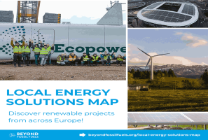
The examples, compiled by Beyond Fossil Fuels, can inform and inspire communities and entrepreneurs that still feel trepidation at the prospect of energy transition
Now you can get your wine in Talence by paying directly in Bitcoin

The 10th European Conference on Sustainable Cities and Towns (ESCT) sets the stage for stronger cooperation between the EU, national and local level to fast track Europe's transition to climate neutrality.

At least, that’s the promise made by the mayor of Paris, Anne Hidalgo
The underground rapid transit lines have been under construction for almost two decades due to various project delays
At least, that’s the promise made by the mayor of Paris, Anne Hidalgo
Hostal de Pinós is located in the geographical centre of the autonomous region
Despite its church-y name, the district has long been known as the hangout spot for the artsy crowds
Urban dwellers across the EU are having a say in making their surroundings friendlier to people and the environment.
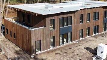
Forests in the EU can help green the European construction industry and bolster a continent-wide push for architectural improvements.

Apply by 10 November and do your part for the transformation of European public spaces
An interview with the Mayor of a Polish city that seeks to reinvent itself
An interview with the newly elected ICLEI President and Mayor of Malmö
A conversation with the Mayor of Lisbon about the spirit and dimensions of innovation present in the Portuguese capital