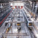
Thessaloniki gets ready for its metro launch in November
The underground rapid transit lines have been under construction for almost two decades due to various project delays
The underground rapid transit lines have been under construction for almost two decades due to various project delays
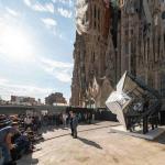
The cross pinnacle on the Tower of Jesus Christ will be ready to receive visitors in 2026 on the centennial of Gaudi’s death

Now you can get your wine in Talence by paying directly in Bitcoin

That’s because the state has to spend money on updating the railway infrastructure rather than subsidizing the cost of the popular pass

Steffen Romstöck said that he would respect the residents’ choice and would take over the helm of the municipality, even if he didn’t run
The measure, which will come into force from 1 January 2025, will be partial and temporary…for now
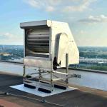
Rethinking renewable energy sources for the urban landscape

But operating them is still illegal under the country’s legislation

The examples, compiled by Beyond Fossil Fuels, can inform and inspire communities and entrepreneurs that still feel trepidation at the prospect of energy transition
Now you can get your wine in Talence by paying directly in Bitcoin
Rethinking renewable energy sources for the urban landscape
The examples, compiled by Beyond Fossil Fuels, can inform and inspire communities and entrepreneurs that still feel trepidation at the prospect of energy transition
The underground rapid transit lines have been under construction for almost two decades due to various project delays
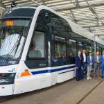
Plus, it has a unique modular design that allows it to be shortened and lengthened like a train

At least, that’s the promise made by the mayor of Paris, Anne Hidalgo
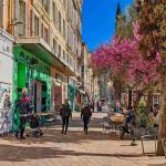
Despite its church-y name, the district has long been known as the hangout spot for the artsy crowds
At least, that’s the promise made by the mayor of Paris, Anne Hidalgo
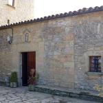
Hostal de Pinós is located in the geographical centre of the autonomous region

On the eve of the new academic year, the ranking considers several distinct but essential factors

Following a successful trial phase, these quiet areas will now be available on all main routes in the country

The academic institution shows a deeper understanding of the well-being of its students


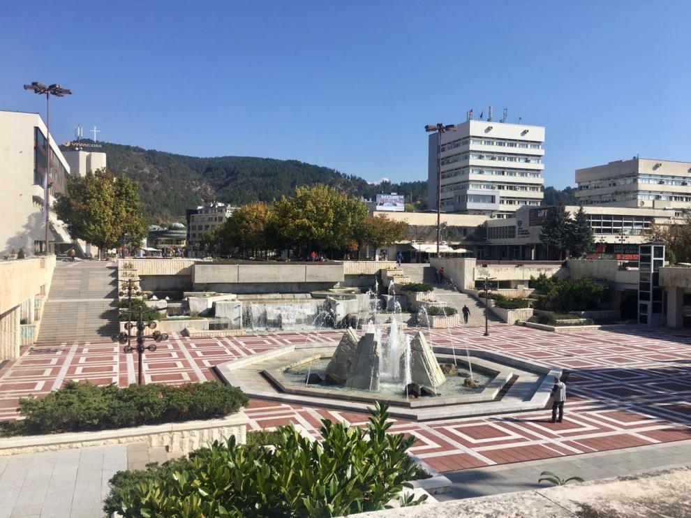
Blagoevgrad is almost the geographic centre of the Balkans - a region in which there are traces from civilized life since the earliest times. There are several known prehistoric settlements from the 6th-5th millennium BC near the city. In Antiquity, there were settlements, fortresses and necropolises inside the city and the surrounding villages. In the Gradishte area, near the village of Drenkovo, archaeological research revealed a late antiquity building from the 4th-6th century with an architectural plan that is unique for the Bulgarian lands. The site was restored, preserved and socialized as a place for cultural tourism. In the 3rd century AD, within the present day’s borders of the city and near the warm healing mineral springs, there was a Thracian settlement called Skaptopara. Not far from the settlement, a “famous fair” took place every year that lasted more than 15 days. Nobody paid taxes for what they sold during the fair. During the reign of Khan Krum, the valley gained military and strategic importance and was part of the plans of the Bulgarian tsars for territorial expansion to the west. In the region around the city of today, a construction of fortresses that had military and security functions was started. The city was liberated from the Ottoman domination only after the Balkan War, on 5 October 1912. Trade and crafts were revived in the 1930s. Branches of several banks were opened. The livеlihood of the population remained the processing and production of tobacco. In 1986-1987, the city was significantly modernized. The new city centre was built, the Varosha Revival and Architectural Complex was restored, and new residential, cultural, industrial and economic buildings were constructed.
Blagoevgrad Municipality is located in the north-western part of the Blagoevgrad Region and with its area of 620,118 sq. km., it is the third biggest municipality in Bulgaria among all 14. The Municipality has a predominantly mountainous relief. Its whole eastern part is taken by the south-western portion of the Rila Mountains, where the highest peak in the Municipality - Golyam Mechi Vrah (2618 m) is located.
Blagoevgrad is situated on both sides of the Bistritsa River. Neofit Rilski South-West University and the American University in Bulgaria can be found here; they are becoming more involved in the cultural and social life of the city, thus making it known as the youngest university centre in Bulgaria.
Blagoevgrad Municipality is situated in close proximity to Greece and FYROM. It has modern transport connections and is rich in cultural and historical landmarks. With its natural beauty and healing mineral waters, it is known as a year-round tourist destination. Blagoevgrad has drawn up a project draft for the construction of a Single International Inter Expo Centre, which will serve as a hub for cross-border business activities. The goal is for entrepreneurs and companies from Bulgaria, Greece and FYROM not only to find partners, but also to exhibit their products and organize conferences. The project will create international business networks that will facilitate the flow of information on supply and demand of services and products across the borders, and will lead to an increase in business activities and to the opening of new jobs. The construction of an industrial park with a production area is planned, where companies with import and export activities at the port of Thessaloniki, Greece, as well as other Bulgarian and foreign production and logistics companies, will operate.
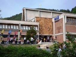
Above its entrance door, the Regional History Museum has a ceramic wall panel called The Spiral of Life. The broken up building of four levels has preserved under its roof a large mural fragment with the images of remarkable historical figures from the Pirin region. The museum hosts an exhibition showing the historical development of the south-west Bulgarian lands from the 7th millennium BC until the present day. There is also an exhibition documenting the struggle for national freedom of the population of the Pirin region.
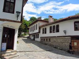
Varosha was established as a quarter of the Christian population of the city at the end of the 17th century. These were the times when the Bulgarians from the surrounding villages, who were engaged in crafts and trade, moved to this place, built their small one-floor houses and lived in peace with the Turkish population. Here, the tourists can see the Dinev’s House, Moshtan’s House, Unchev’s House, Izmirliev’s House, etc.
Address: 2700 Blagoevgrad, 1 Georgi Izmirliev Square

