Thessaloniki gets ready for its metro launch in November
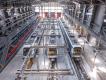
The underground rapid transit lines have been under construction for almost two decades due to various project delays
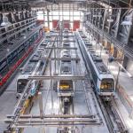
The underground rapid transit lines have been under construction for almost two decades due to various project delays

The cross pinnacle on the Tower of Jesus Christ will be ready to receive visitors in 2026 on the centennial of Gaudi’s death

Now you can get your wine in Talence by paying directly in Bitcoin

That’s because the state has to spend money on updating the railway infrastructure rather than subsidizing the cost of the popular pass

Steffen Romstöck said that he would respect the residents’ choice and would take over the helm of the municipality, even if he didn’t run

The measure, which will come into force from 1 January 2025, will be partial and temporary…for now
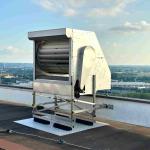
Rethinking renewable energy sources for the urban landscape

But operating them is still illegal under the country’s legislation

The examples, compiled by Beyond Fossil Fuels, can inform and inspire communities and entrepreneurs that still feel trepidation at the prospect of energy transition
Now you can get your wine in Talence by paying directly in Bitcoin
Rethinking renewable energy sources for the urban landscape
The examples, compiled by Beyond Fossil Fuels, can inform and inspire communities and entrepreneurs that still feel trepidation at the prospect of energy transition
The underground rapid transit lines have been under construction for almost two decades due to various project delays

Plus, it has a unique modular design that allows it to be shortened and lengthened like a train

At least, that’s the promise made by the mayor of Paris, Anne Hidalgo

Despite its church-y name, the district has long been known as the hangout spot for the artsy crowds
At least, that’s the promise made by the mayor of Paris, Anne Hidalgo
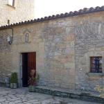
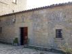
Hostal de Pinós is located in the geographical centre of the autonomous region

On the eve of the new academic year, the ranking considers several distinct but essential factors
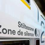
Following a successful trial phase, these quiet areas will now be available on all main routes in the country

The academic institution shows a deeper understanding of the well-being of its students


The Irish Environment Protection Agency released an updated map of affected regions in the country
On Wednesday, the Irish Environmental Protection Agency (EPA) published an updated radon map of the country, providing a more accurate depiction of the areas where people are more at risk of exposure to the radioactive material.
According to the new data, around half a million people could be exposed to the substance in their homes or at work. Overexposure to radon can cause lung cancer and estimates suggest that it accounts for 350 lung cancer cases every year in Ireland.
Radon is an odourless, colourless and tasteless radioactive gas that is released from the decay of uranium in rocks and soils. The gas is a particular concern for homes, as it tends to seep in from cracks and gaps and accumulate in the air and in certain surfaces, similar to asbestos.
At the same time, the national distribution of radon intensive areas is quite uneven. It depends on factors like geology – certain types of rocks and deposits - including some granites, limestone and shales - tend to be associated with high radon emissions. Experts say that Cork and Waterford and the western seaboard account for the highest levels in the country.
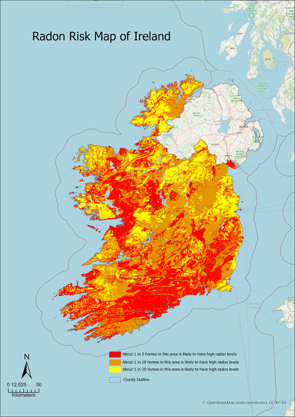 A map of radon regions in Ireland, Source: Environment Protection Agency
Outdoors, radon quickly dilutes and is harmless, however, in enclosed spaces, it can accumulate with health-damaging effects, especially when breathed in. According to Irish authorities, exposure to radon accounts for approximately 350 cases of lung cancer every year.
However, dealing with the substance at home or in an office is quite easy. Irish buildings built after 1998 have a mandatory radon sump – a pipe which leads to the open air. If an enclosed space does exhibit high radon counts, the sump can be activated with a fan, increasing ventilation.
Irish authorities have long been aware of their radioactive problem. This is why they created the National Radon Control Strategy, a cross-institution initiative, led by the Department of Environment and Climate. Their main goal is to reduce the number of radon-related lung cancer cases in Ireland.
This is why in 2002, they developed the first radon map of Ireland. Now, with the help of Trinity College, the Geological Survey of Ireland and the Economic and Social Research Institute, along with the EPA, they have updated the map and provided additional detail.
According to the new map, an astounding 170,000 homes in the country are at risk for radon exposure. This equates to roughly half a million people. Luckily, the EPA now offers digital services, so people can see if their home or workplace is affected, by using their eircode.
The underground rapid transit lines have been under construction for almost two decades due to various project delays

Now you can get your wine in Talence by paying directly in Bitcoin

That’s because the state has to spend money on updating the railway infrastructure rather than subsidizing the cost of the popular pass
Rethinking renewable energy sources for the urban landscape

The examples, compiled by Beyond Fossil Fuels, can inform and inspire communities and entrepreneurs that still feel trepidation at the prospect of energy transition
Now you can get your wine in Talence by paying directly in Bitcoin

The 10th European Conference on Sustainable Cities and Towns (ESCT) sets the stage for stronger cooperation between the EU, national and local level to fast track Europe's transition to climate neutrality.

At least, that’s the promise made by the mayor of Paris, Anne Hidalgo
The underground rapid transit lines have been under construction for almost two decades due to various project delays
At least, that’s the promise made by the mayor of Paris, Anne Hidalgo
Hostal de Pinós is located in the geographical centre of the autonomous region
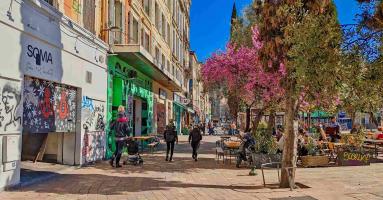
Despite its church-y name, the district has long been known as the hangout spot for the artsy crowds
Urban dwellers across the EU are having a say in making their surroundings friendlier to people and the environment.
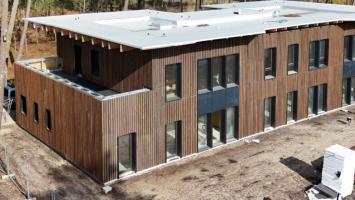
Forests in the EU can help green the European construction industry and bolster a continent-wide push for architectural improvements.

Apply by 10 November and do your part for the transformation of European public spaces
An interview with the Mayor of a Polish city that seeks to reinvent itself
An interview with the newly elected ICLEI President and Mayor of Malmö
A conversation with the Mayor of Lisbon about the spirit and dimensions of innovation present in the Portuguese capital