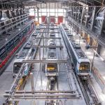
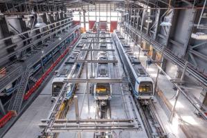
Thessaloniki gets ready for its metro launch in November
The underground rapid transit lines have been under construction for almost two decades due to various project delays
The underground rapid transit lines have been under construction for almost two decades due to various project delays

The cross pinnacle on the Tower of Jesus Christ will be ready to receive visitors in 2026 on the centennial of Gaudi’s death

Now you can get your wine in Talence by paying directly in Bitcoin

That’s because the state has to spend money on updating the railway infrastructure rather than subsidizing the cost of the popular pass

Steffen Romstöck said that he would respect the residents’ choice and would take over the helm of the municipality, even if he didn’t run

The measure, which will come into force from 1 January 2025, will be partial and temporary…for now

Rethinking renewable energy sources for the urban landscape

But operating them is still illegal under the country’s legislation

The examples, compiled by Beyond Fossil Fuels, can inform and inspire communities and entrepreneurs that still feel trepidation at the prospect of energy transition
Now you can get your wine in Talence by paying directly in Bitcoin
Rethinking renewable energy sources for the urban landscape
The examples, compiled by Beyond Fossil Fuels, can inform and inspire communities and entrepreneurs that still feel trepidation at the prospect of energy transition
The underground rapid transit lines have been under construction for almost two decades due to various project delays

Plus, it has a unique modular design that allows it to be shortened and lengthened like a train

At least, that’s the promise made by the mayor of Paris, Anne Hidalgo

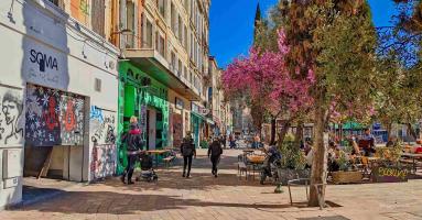
Despite its church-y name, the district has long been known as the hangout spot for the artsy crowds
At least, that’s the promise made by the mayor of Paris, Anne Hidalgo

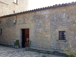
Hostal de Pinós is located in the geographical centre of the autonomous region

On the eve of the new academic year, the ranking considers several distinct but essential factors


Following a successful trial phase, these quiet areas will now be available on all main routes in the country

The academic institution shows a deeper understanding of the well-being of its students


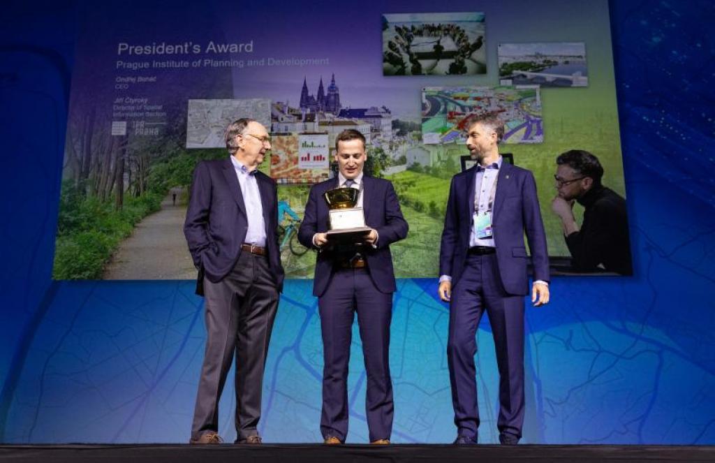
IPR director Ondřej Boháč and Jiří Čtyroký, director of the Spatial Information Section receiving the award from Esri president Jack Dangermond, Source: IPR via City of Prague
A considerable amount of the data, collected by the city, is also open to the public
Prague’s Institute of Planning and Development (IPR) has just won one of the world's most prestigious awards in the field of data and geography, as the city website informed yesterday. The award, given by Esri – a leading geographic information system (GIS) software provider – recognizes the capital’s long-term use of data for urban planning and mitigating the effects of climate change.
In particular, Prague was praised for effectively transforming information into green and economic solutions that improve the life quality of its citizens and guests.
At the conference in San Diego, California, watched by over 30,000 spectators, the Czech capital received the highest award by Esri – or the “Oscar for data” as the city website refers to it. This ranks Prague alongside cities such as New York and Philadelphia, which have also received this recognition in the past.
The praise is mainly for Prague’s use of GIS in urban planning. Thanks to the operation of its geoportal and all applications such as the digital spatial plan, heat map, technical infrastructure drawings and others, Prague can develop systematically and efficiently.
"We run the city based on data. It is an essential method of modern management of the metropolis of the 21st century. Thanks to this, we manage to monitor the traffic flow in the city on a daily basis, solve urban planning efficiently or manage waste smartly.
By the way, it has also proven itself in two unprecedented crises that Prague has been exposed to in the last four years - both in the covid pandemic and now during the Russian dictator's invasion of Ukraine and the related refugee crisis," commented Mayor Zdeněk Hřib, as quoted on the city website.
City officials further pointed out that data is the cornerstone of the Institute for Planning and Development and that the data is freely accessible to the general public.
At the conference, IPR was also awarded for the innovative and significant deployment of geoinformation technologies. Territorial analytical documents used in Prague contain information on the state and development of the capital's territory, its values, planned development and limits and problems, as well as essential data on transport and climate.
The Portal of Territorial Analytical Documents, where these documents can be found, was highly evaluated for the volume and quality of the published data, and especially for the innovative way of presenting individual outputs. Through its portal, IPR provides data and information to experts, developers, politicians and the general public in one place.
The underground rapid transit lines have been under construction for almost two decades due to various project delays

Now you can get your wine in Talence by paying directly in Bitcoin

That’s because the state has to spend money on updating the railway infrastructure rather than subsidizing the cost of the popular pass

Rethinking renewable energy sources for the urban landscape

The examples, compiled by Beyond Fossil Fuels, can inform and inspire communities and entrepreneurs that still feel trepidation at the prospect of energy transition
Now you can get your wine in Talence by paying directly in Bitcoin

The 10th European Conference on Sustainable Cities and Towns (ESCT) sets the stage for stronger cooperation between the EU, national and local level to fast track Europe's transition to climate neutrality.

At least, that’s the promise made by the mayor of Paris, Anne Hidalgo
The underground rapid transit lines have been under construction for almost two decades due to various project delays
At least, that’s the promise made by the mayor of Paris, Anne Hidalgo
Hostal de Pinós is located in the geographical centre of the autonomous region
Despite its church-y name, the district has long been known as the hangout spot for the artsy crowds
Urban dwellers across the EU are having a say in making their surroundings friendlier to people and the environment.
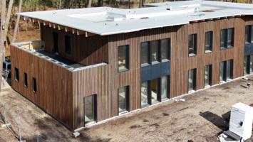
Forests in the EU can help green the European construction industry and bolster a continent-wide push for architectural improvements.

Apply by 10 November and do your part for the transformation of European public spaces
An interview with the Mayor of a Polish city that seeks to reinvent itself
An interview with the newly elected ICLEI President and Mayor of Malmö
A conversation with the Mayor of Lisbon about the spirit and dimensions of innovation present in the Portuguese capital