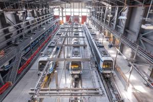
Thessaloniki gets ready for its metro launch in November
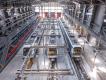
The underground rapid transit lines have been under construction for almost two decades due to various project delays
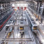
The underground rapid transit lines have been under construction for almost two decades due to various project delays
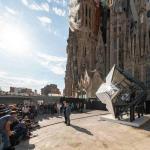
The cross pinnacle on the Tower of Jesus Christ will be ready to receive visitors in 2026 on the centennial of Gaudi’s death

Now you can get your wine in Talence by paying directly in Bitcoin

That’s because the state has to spend money on updating the railway infrastructure rather than subsidizing the cost of the popular pass

Steffen Romstöck said that he would respect the residents’ choice and would take over the helm of the municipality, even if he didn’t run
The measure, which will come into force from 1 January 2025, will be partial and temporary…for now
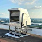
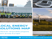
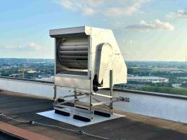
Rethinking renewable energy sources for the urban landscape

But operating them is still illegal under the country’s legislation
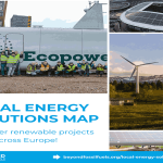
The examples, compiled by Beyond Fossil Fuels, can inform and inspire communities and entrepreneurs that still feel trepidation at the prospect of energy transition
Now you can get your wine in Talence by paying directly in Bitcoin
Rethinking renewable energy sources for the urban landscape
The examples, compiled by Beyond Fossil Fuels, can inform and inspire communities and entrepreneurs that still feel trepidation at the prospect of energy transition
The underground rapid transit lines have been under construction for almost two decades due to various project delays

Plus, it has a unique modular design that allows it to be shortened and lengthened like a train

At least, that’s the promise made by the mayor of Paris, Anne Hidalgo
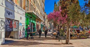
Despite its church-y name, the district has long been known as the hangout spot for the artsy crowds
At least, that’s the promise made by the mayor of Paris, Anne Hidalgo
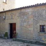
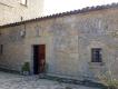
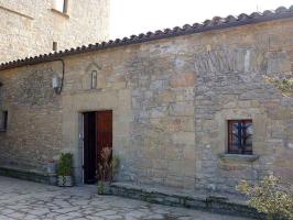
Hostal de Pinós is located in the geographical centre of the autonomous region

On the eve of the new academic year, the ranking considers several distinct but essential factors

Following a successful trial phase, these quiet areas will now be available on all main routes in the country

The academic institution shows a deeper understanding of the well-being of its students


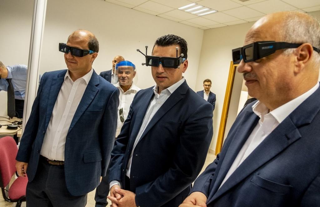
Minister for the Environment, Climate Change and Planning Aaron Farrugia (centre) visits the SIntegram CAVE, Source: Minister for the Environment, Climate Change and Planning Aaron Farrugia (centre) visits the SIntegram CAVE . Photo: https://environment.gov.mt
The EU-funded project will create an integrated information system to facilitate environmental monitoring and planning
Imagine Malta as a multidimentional world, offering a capability to be explored through virtual reality, augmented reality, and mixed reality. This is not a sci-fi scenario, but a realistic goal in the scope of SIntegraM, an EU project partially financed with EUR 7 million by the European Regional Development Fund (ERDF) and led by the Planning Authority of Malta.
SIntegraM is focused on the creation of an integrated information system collecting data about the natural environment from different entities and partners. This centralized system will be receiving information from land and submarine sources, and from above by means of drones and will produce a virtual image of various locations. This will allow a more detailed outlook on the Maltese environment and will facilitate the planning process in implementing environmental actions.
This project benefits society as it can take a snapshot of our environment, travel within it, review the changes that would occur, understand the rise of sea levels, and myriad other possibilities, Minister for the Environment, Climate Change and Planning Aaron Farrugia said during a visit to the SIntegram CAVE (Computer Automated Virtual Environment). He explained that this system will make proposing and monitoring of green infrastructure much easier, as well as provide tools to spot and trace infringements.
“Since the launch of the Cloudisle Initiative that depicted the first 3D map of the Maltese Islands in 2017, technologies have advanced drastically, and the University has been instrumental in ensuring that this project has tangible goods for society. Through insight and inter-entity collaboration, we have pushed for foresight, and then pushed the envelope for social wellbeing,” said Prof. Saviour Formosa, who conceptualised and drove the SIntegraM project, quoted by the Environment Ministry’s website.
Project leader Ashley Hili revealed that through SIntegraM the Planning Authority aims to develop a national spatial data infrastructure and enhance the capacity of geo-spatial/GIS technology expertise for Malta. She said that the project is set on forging a strategic approach to spatial data, creation of critical base datasets, as well as enabling a legislative and mentality shift regarding the exchange and access to data.
The underground rapid transit lines have been under construction for almost two decades due to various project delays

Now you can get your wine in Talence by paying directly in Bitcoin

That’s because the state has to spend money on updating the railway infrastructure rather than subsidizing the cost of the popular pass
Rethinking renewable energy sources for the urban landscape
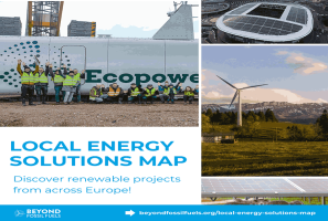
The examples, compiled by Beyond Fossil Fuels, can inform and inspire communities and entrepreneurs that still feel trepidation at the prospect of energy transition
Now you can get your wine in Talence by paying directly in Bitcoin
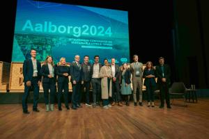
The 10th European Conference on Sustainable Cities and Towns (ESCT) sets the stage for stronger cooperation between the EU, national and local level to fast track Europe's transition to climate neutrality.

At least, that’s the promise made by the mayor of Paris, Anne Hidalgo
The underground rapid transit lines have been under construction for almost two decades due to various project delays
At least, that’s the promise made by the mayor of Paris, Anne Hidalgo
Hostal de Pinós is located in the geographical centre of the autonomous region
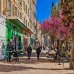
Despite its church-y name, the district has long been known as the hangout spot for the artsy crowds
Urban dwellers across the EU are having a say in making their surroundings friendlier to people and the environment.
Forests in the EU can help green the European construction industry and bolster a continent-wide push for architectural improvements.

Apply by 10 November and do your part for the transformation of European public spaces
An interview with the Mayor of a Polish city that seeks to reinvent itself
An interview with the newly elected ICLEI President and Mayor of Malmö
A conversation with the Mayor of Lisbon about the spirit and dimensions of innovation present in the Portuguese capital