Thessaloniki gets ready for its metro launch in November
The underground rapid transit lines have been under construction for almost two decades due to various project delays
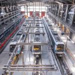
The underground rapid transit lines have been under construction for almost two decades due to various project delays
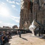
The cross pinnacle on the Tower of Jesus Christ will be ready to receive visitors in 2026 on the centennial of Gaudi’s death

Now you can get your wine in Talence by paying directly in Bitcoin

That’s because the state has to spend money on updating the railway infrastructure rather than subsidizing the cost of the popular pass

Steffen Romstöck said that he would respect the residents’ choice and would take over the helm of the municipality, even if he didn’t run

The measure, which will come into force from 1 January 2025, will be partial and temporary…for now
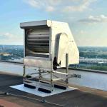
Rethinking renewable energy sources for the urban landscape

But operating them is still illegal under the country’s legislation

The examples, compiled by Beyond Fossil Fuels, can inform and inspire communities and entrepreneurs that still feel trepidation at the prospect of energy transition
Now you can get your wine in Talence by paying directly in Bitcoin
Rethinking renewable energy sources for the urban landscape
The examples, compiled by Beyond Fossil Fuels, can inform and inspire communities and entrepreneurs that still feel trepidation at the prospect of energy transition
The underground rapid transit lines have been under construction for almost two decades due to various project delays

Plus, it has a unique modular design that allows it to be shortened and lengthened like a train

At least, that’s the promise made by the mayor of Paris, Anne Hidalgo
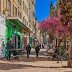
Despite its church-y name, the district has long been known as the hangout spot for the artsy crowds
At least, that’s the promise made by the mayor of Paris, Anne Hidalgo
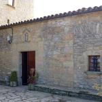
Hostal de Pinós is located in the geographical centre of the autonomous region

On the eve of the new academic year, the ranking considers several distinct but essential factors
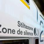
Following a successful trial phase, these quiet areas will now be available on all main routes in the country

The academic institution shows a deeper understanding of the well-being of its students


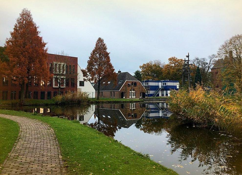
Lingewaard municipality has an almost two decades-long history, as it was formed in 2001. Its creation is the result of a merger between what used to be three separate municipalities - Bemmel, Gendt and Huissen. Initially named Bemmel after the largest of the three, it was renamed to 'Lingewaard' in a referendum.
Lingewaard is a municipality located in the Dutch province of Gelderland, in the eastern Netherlands. Its population as of 2020 counts 46,615 inhabitants (lingewaard.nl) and it has an area of 69.14 square kilometres. Its population is mostly concentrated in Huissen, Bemmel and Gendt.
Until 2015 it belonged to the Arnhem–Nijmegen metropolitan area.
Originally, Lingewaard was an area of greenhouse horticulture. The many horticultural businesses and the innovative glasshouse horticultural zone NEXTgarden are an important economic factor for the local development.
The ambition of NEXTgarden is to be the first climate-neutral horticultural zone in the country. Within NEXTgarden, Lingezegen Energy, a collective company of 14 horticultural enterprises, operates its own energy network.
Educational institutions and authorities in the region - Wageningen University, Radboud University, Van Hall Larenstein in Velp, the Economic Board and the Province of Gelderland contribute to Lingewaard’s growth.
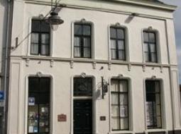
The museum, which is housed in the same building as the circle residence, has a large hall with a permanent exhibition. Within it one can find exhibits dating to the different periods in the history of Huissen, from prehistoric times to the present.
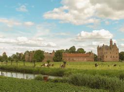
This large, beautiful medieval castle is believed to be among the biggest and impressive medieval fortresses in the Netherlands. Behind the doors of the gatehouse and the strong weather walls surrounding the spacious courtyard there is a farm, a chapel and a residential tower.
The fact that De Doornenburg has a farm within its gates makes it a rather unique castle in the Netherlands. Guided tours are organized at regular times and additional tours are available on request outside of these set times.a
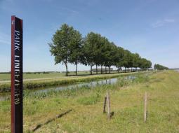
The municipality of Lingewaard is located in the De Gelderse Poort national landscape, at the split of the Rhine into the Waal and the Nederrijn (Lower Rhine) / Pannerdens Kanaal which splits into the IJssel as the Lower Rhine near Huissen.
The extensive floodplains along the rivers are particularly interesting from a natural and landscape perspective. From the dikes, the view over the water and the land is also impressive.

